

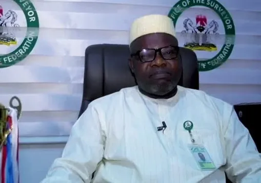
The Surveyor-General of the Federation, AbdulGaniyu Adebomehin, has said expanding Nigeria’s network of geodetic stations will improve security operations, including counter-insurgency efforts, search and rescue missions and emergency response.
He disclosed that Nigeria had established only 51 of the 200 Continuously Operating Reference Stations recommended by the United Nations, describing the gap as a challenge to the country’s geospatial infrastructure and security capabilities.
Represented by the Director of Geodesy, Joseph Magaji, at the General Assembly and Scientific Conference of the Nigeria Association of Geodesy held in Abuja on Wednesday, Adebomehin said accurate mapping and geodetic information were essential to effective national security planning and operations.
He said, “The United Nations has advised that countries require CORS infrastructure, and Nigeria has developed only 51 of the 200 recommended stations. Yet CORS is directly valuable for combating insurgency, search and rescue, and emergency response because it allows personnel to pinpoint locations with precision. Expanding this network is not a luxury; it is a security enabler.
“CORS is directly valuable for combating insurgency, search and rescue, and emergency response because it allows personnel to pinpoint locations with precision.
“Expanding this network is not a luxury; it is a security enabler.”
Adebomehin described geodesy as a critical component of national security, saying accurate mapping and geodetic information were necessary for planning and executing security operations.
He said, “The OSGoF’s mandate is clear: to provide the geospatial information needs of this country for sustainable national development, and to undertake vital surveys and maps required for long-term strategies in national defence and security.
“Geodesy is not an academic curiosity sitting at the edge of national security. It is the reference frame upon which security operations stand or fall.”
The Surveyor-General said Nigeria also needed to embrace emerging technologies, including artificial intelligence, Earth observation, autonomous systems and next-generation satellite navigation, to improve the use of geospatial intelligence by security agencies and development planners.
He said the integration of Global Navigation Satellite Systems with artificial intelligence and Earth observation could transform conventional maps into dynamic information for decision-making.
Continuously Operating Reference Stations are ground-based facilities equipped with satellite positioning receivers that continuously collect location data from Global Navigation Satellite Systems.
The information helps improve the accuracy of positioning and mapping by providing reference data against which other receivers can determine their locations.
READ ALSO:
- State police: Senate completes amendment process, seeks Tinubu’s assent
- Police tighten security ahead of Tinubu rally, Obi’s Anambra visit
- American strategist deletes posts on Tinubu, Nigeria-US security ties
Also speaking, the Chief of Defence Space Administration, Maj. Gen. P. O. Ilodibia, represented by the Deputy Director, Space Operations, Commodore Charles Iso, said geodetic data and space-based technologies were critical to military intelligence, operational effectiveness and border surveillance.
He said accurate positioning and gravity field information would enhance target geolocation, intelligence gathering and the coordination of information from satellites, aircraft and ground sensors.
According to him, the absence of a reliable national reference frame could affect the accuracy and operational value of intelligence gathered from different platforms.
“Without a common high-integrity national reference frame, fusion of data from satellites, aircraft, and ground sensors loses accuracy and operational value,” he said.
Ilodibia said geodetic technologies, including satellite navigation systems and radar interferometry, could also support the monitoring of international boundaries, detection of unauthorised activities and tracking across difficult terrain.
He warned that disruptions to space-enabled geodetic services could affect military operations and critical national infrastructure, urging the country to prioritise the protection and resilience of its space and geodetic infrastructure.
The Chief of Defence Space Administration called for stronger collaboration among geodesists, space scientists, defence institutions, universities, government agencies and private organisations to translate research into practical security applications.
Earlier, the National President of the Nigeria Association of Geodesy, Prof. T. O. Idowu, said geospatial intelligence was becoming increasingly important to Nigeria’s national security architecture.
He said geodesists could contribute to the development of indigenous geospatial intelligence capabilities through their expertise in positioning, reference systems, spatial measurements, Earth observation and geospatial data quality.
Idowu also identified gravimetry as an important tool for investigating underground mineral deposits, geological structures and other subsurface features.
He said integrating gravity measurements with Global Navigation Satellite Systems, geological information and artificial intelligence would improve subsurface investigations and resource management.
He urged researchers, institutions and government agencies to strengthen collaboration in developing indigenous geospatial intelligence capabilities.
